 "Becca di Vlou vista dalla Becca Torche'")
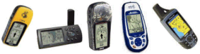
Per come arrivare a San Grato si rimanda a quanto detto nell'apposita gita (Da Issime alla cappella di San Grato). In alternativa, anziche' effettuare tutto il percorso a piedi partendo da Issime, e' possibile salire lungo la strada in auto per un primo tratto e proseguire poi a piedi lungo la strada stessa o sulla mulattiera che incrocia la strada piu' volte. ARRIVO: Becca Torché (3016 m) QUOTA MASSIMA: 3016 m DISLIVELLO: 1349 m LUNGHEZZA: 6.2 Km (12.4 Km) DURATA: 4:10 h (7:00 h) PERCORSO: Da San Grato si segue il sentiero sulla sinistra della cappella marcato 1 oppure 1C con segni gialli. Si supera una sorgente collocata sotto un arco di pietra in cui si vede l'apertura di un antico forno e si prosegue oltre una serie di baite fino ad entrare nel bosco. Dopo circa 20 minuti si attraversa un ruscello su un tronco d'albero e si intraprende una salita a tornanti che porta a Muhnes (2021 m). Qui, nel pianoro, si trovano due case: quella con la facciata bianca e' una cappella intitolata alla Madonna delle Nevi, anche se esternamente non riporta segni di carattere religioso che ne lascino intuire la funzione. Spostandosi a destra, vicino all'angolo della seconda baita, si vede ai piedi della montagna una casa appoggiata ad una roccia: e' Schtein (2040 m), da li parte il sentiero per la Torche'. Per arrivarci si attraversa il prato (in estate l'erba puo' essere alta e non si vedono tracce). Si supera un ruscello e si passa a destra della roccia e delle costruzioni ad essa appoggiate, fino a vedere degli omini in pietra e dei segni rossi. Dopo un'ora circa la ripida salita porta all'alpe Habru Vlou (2370 m). Una volta superate le case si gira a destra, verso un roccione, in modo da ritrovare i bolli rossi. La salita prosegue tra pascoli e rocce fin sotto una lastra di pietra dove il sentiero s'inerpica su un muretto (1 ora circa dall'Alpe Vlou). Si seguono ancora gli omini e i bolli rossi che portano alla cresta (50 min. dalla lastra di pietra). La camminata prosegue per altri 40 minuti e poi, finalmente, la vetta! NOTE: L'utilizzo del Gps e' consigliabile per affrontare questa gita perche' in diversi punti gli omini ed i bolli rossi sono difficili da individuare. Sulla cresta occorre prestare attenzione ad alcune rocce mobili e friabili. Sulla cima il panorama e' ampio e dal lato di Challand la montagna scende a strapiombo. See San Grato excursion about how to get the starting point (From Issime to San Grato chapel). Otherwise starting from Issime, it is possible to rise by car on the road for a while and then continue walking on the same road or on the footpath that crosses the road several times. END: Becca Torche' peak (3016 m) MAX ALTITUDE: 3016 m ALTITUDE DIFFERENCE: 1349 m LENGTH: 6.2 Km (12.4 Km) DURATION: 4:10 h (7:00 h) PATH: Follow the footpath on the left side of San Grato Chappel marked with yellow sign 1 or 1C. Get over a spring hided under a stone arc, reach a cluster of houses and enter in the wood. After about 20 minutes overcome a stream by a trunk and start to climb a steep slope which conduces to Muhnes (2021 m). Two houses rise in the tableland: the white house is a chappel devoted to Our Lady of Snow, even if no external religious sign let guess this function. Moving on the right, near the corner of the second building, you can see an house leaned against a rock: it is Schtein (2040 m). From that point starts the path for the Becca Torché peak. To join it, it is necessary to cross the meadow (during the summer the the hight grass hides every hint). Cross a stream and follow the path on the right of the houses, where red and stone marks stand. After about one hour of steep slope you get to the Habru Vlou alpine pasture (2370 m). Further the houses you turn on the right, in direction of a rock in order to find the red mark of the path. The slope keep on among grazing ground and stones as far as a rock where the track climbs on a little wall (about 1 hour from Habru Vlou). Follow the marks to get the ridge (50 min. from the little wall). The walking keeps on for 40 minutes longer and at last you have come! NOTES: Red and stone marks are not easy to be found in some part of the walking: GPS can help you in order to find the good way. Keep attention to some moving and crumbly stones on the ridge. On the summit you can enjoy a fine view: on Challand side the peak falls perpendicularly. |
 "Sorgente e vecchio forno")  "L'alpeggio di Muhnes")  "Ivrea ed il Canavese visti dall Becca Torche'")  "Val d'Ayas vista dalla Becca Torche'")
|
|
|